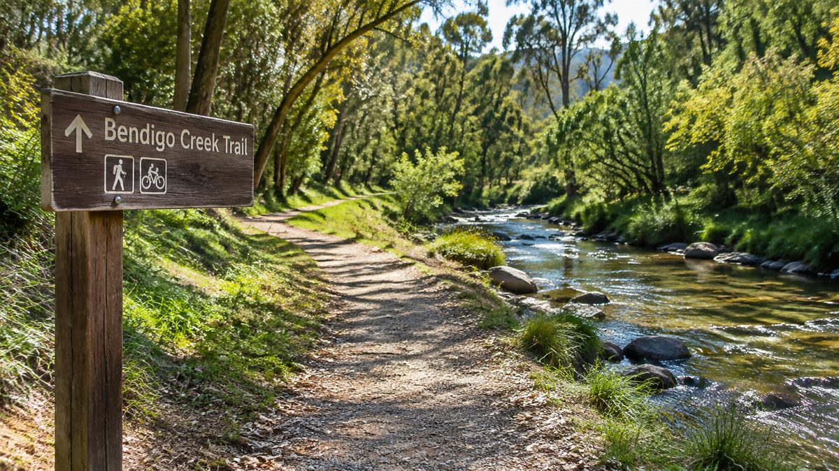
Bendigo Creek Trail: Route, Distance, Access Points and Facilities
The Bendigo Creek Trail is a mostly flat shared path that links Bendigo’s southern suburbs, city centre and northern recreation areas. The full corridor is about 17 kilometres, though the distance you cover will depend on the current endpoint, local connections and any detours. Most people use one section rather than complete the whole trail. Its gentle grade suits Walking, Cycling, family rides and practical trips into central Bendigo.
The route follows Bendigo Creek and nearby urban corridors through Kangaroo Flat, Golden Square, the city centre, Lake Weeroona and areas farther north. It passes homes, parks, shops and road crossings. This makes it useful as both Cycling infrastructure and a linear Recreation space.
The trail is easy to join from many streets, but conditions change along its length. Some sections feel like a park path. Others pass behind buildings or run close to roads. Signs, surfaces and available facilities also vary. Check the latest City of Greater Bendigo trail map before setting out, especially after floods, drainage works or path upgrades.
Where does the route take you?
The southern part begins around Kangaroo Flat and the Crusoe Reservoir area. Connections lead toward the Bendigo Creek corridor, then north through Golden Square and into central Bendigo. The trail continues past the edge of the central business district toward Lake Weeroona. From there, northern links serve White Hills, the Bendigo Botanic Gardens and nearby suburbs.
Do not expect every metre to sit beside open water. Bendigo Creek is an urban waterway. In places, the path follows the creek closely. Elsewhere, it shifts beside streets, drains, reserves and developed land. Road crossings and local path links can make the route less clear than a single country rail trail.
South to north is the easiest way to picture the route:
- Kangaroo Flat and Crusoe Reservoir: A useful southern starting area for riders who want a longer outing.
- Golden Square: A suburban section with several street connections and places to leave the trail.
- Central Bendigo: The most useful section for shops, food, public toilets and links to other paths.
- Lake Weeroona: A clear landmark with open space and options for a rest.
- White Hills and the Bendigo Botanic Gardens: A greener northern section suited to shorter walks and family trips.
Several side paths connect with local streets and reserves. That helps people build a loop or ride from home, but it can also cause a wrong turn. At an unclear junction, stay with signs for the creek corridor rather than following a path simply because it looks wider.
How far should you plan to travel?
Allow for about 17 kilometres when planning a one-way trip along the main corridor. A full out-and-back ride may reach 34 kilometres before side trips. That is manageable for regular riders, but it is a long walk.
Map distances can differ because the trail has changed over time and because maps do not always use the same endpoints. A route starting beside Crusoe Reservoir may be longer than one measured from central Kangaroo Flat. Northern extensions and connecting paths can also change the total.
A practical plan is to choose two fixed landmarks and measure between them. For example, a visitor could ride from central Bendigo to Lake Weeroona and continue to the Botanic Gardens if time and energy allow. A family could start at Lake Weeroona, travel north for a set time, then return by the same path.
Allow more time than the distance alone suggests. Street crossings, pedestrians, dogs and route checks slow the pace. A relaxed rider may cover the full one-way route in roughly 75 to 100 minutes. A brisk walker may need more than three hours. Stops can add far more time.
A common planning mistake is treating a 17-kilometre route as a 17-kilometre day. If your car is at the starting point, the return doubles the distance. Arrange a pickup, use public transport where practical or choose a shorter return trip.
What is the surface and riding experience like?
Most of the main route uses a formed shared path, with sealed sections through much of the urban corridor. Some connecting paths may use a different surface. Drainage debris, cracked edges, wet leaves or temporary works can affect short sections.
The grade is generally gentle because the route follows the creek corridor. That makes it friendlier than Bendigo’s hillier road routes. Yet flat does not mean effortless. Wind, heat and repeated crossings can tire new riders.
Use a roadworthy Bicycle with working brakes. A hybrid, commuter bike or mountain bike is a simple choice. Narrow road tyres may be fine on sealed sections, but they offer less comfort where a connection becomes rough.
Cycling speeds should match the setting. Ring a bell before passing, leave space and slow down near children, dogs or blind corners. Keep left unless signs direct otherwise. Riders must pay close attention where the trail crosses roads or driveways.
Walking is straightforward on most sections, though shade varies. Summer heat can make exposed parts uncomfortable. Start early, carry water and use sun protection. After heavy rain, low points beside the creek may hold silt or water even when nearby streets are dry.
Where does the trail demand extra care?
Road crossings are the main points that demand attention. A shared path can create a false sense of separation from traffic. Slow before each crossing, check both directions and obey signs or signals. Never assume a driver has seen you.
Creek corridors can also flood. Water may rise quickly after strong rain, while mud and branches can remain after it falls. Do not enter floodwater or pass a closure barrier. Choose a street route only if you can do so legally and safely.
Some sections have limited lighting. Finish before dark unless you have suitable lights and know the route. Riders need front and rear lights after sunset, while walkers benefit from visible clothing.
Shared use calls for patience. Keep dogs controlled and move aside before stopping. Riders should pass at a low speed after giving warning. Headphones should stay quiet enough for the wearer to hear bells, traffic and other people.
How can you plan a trip without wasting time?
Start with the distance you can comfortably repeat. Then choose a landmark halfway through that limit. This protects you from the most common error: enjoying an easy outward ride before discovering that the return feels much harder.
Use this trip plan:
- Check the latest council trail map, weather and closure notices.
- Choose two named landmarks and measure the route between them.
- Confirm toilets, water and legal parking near those landmarks.
- Carry water, sun protection, a charged phone and a basic repair kit when riding.
- Turn back early if heat, flooding, poor light or fatigue changes the plan.
A practical first visit starts at Lake Weeroona or central Bendigo because both areas are easy to identify and close to services. Travel north or south for 20 to 30 minutes, then return along the same route. This gives you a clear look at signs, crossings and path conditions before attempting the full corridor.
Choose one easy-to-find access point, set a firm turnaround distance and check current trail conditions before leaving.
Along the Bendigo Creek Trail, access and facilities vary by location, with a Parking lot, Bicycle parking, Rail transport connections, a Drinking fountain and Picnic areas available near selected sections of the route.