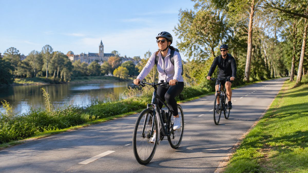
Cycling in Bendigo: Shared Paths, Recreational Routes and Bike Facilities
Bendigo gives riders a useful mix of traffic-free shared paths, quiet recreational routes and facilities for everyday bike trips. The best option depends on whether you want an easy family ride, a direct trip across town or a longer day on a Rail trail. The network is still uneven in places, so a good ride starts with choosing the right type of route rather than following the shortest line on a map.
The main idea is simple: use shared paths as the safe base of your trip, then add quiet streets or a recreational trail only when they suit your skill and bike. This approach makes cycling in Greater Bendigo easier for new riders while giving regular cyclists room to build longer routes.
Which routes work best for an easy ride?
The Bendigo Creek Trail is the clearest starting point for many casual riders. It follows the Bendigo Creek corridor through parts of the urban area and keeps riders away from traffic for much of the journey. It is useful for short exercise rides, family outings and travel between nearby neighbourhoods.
The trail suits riders who value a simple route more than speed. You can ride for a set time, turn around and return along the same path. That removes the risk of reaching a difficult road crossing or finding yourself farther from home than planned.
Shared paths are used by walkers, runners, children and people with dogs. Keep left, slow down before passing and ring your bell early. A path may look empty, but driveways, side paths and underpasses can hide other users. Wet leaves and loose gravel also need more stopping distance.
In my experience, a first ride works better when the route has one clear turnaround point. A new rider who plans to “see how far we get” often uses most of their energy on the outward leg. A named park, bridge or road crossing gives the group an easy decision point.
How does the creek corridor connect the city?
Bendigo Creek acts as more than a waterway. Its corridor provides space for an off-road route through built-up parts of Bendigo. That makes it valuable where busy roads would otherwise split neighbourhoods.
The Bendigo Creek Trail can form the spine of a local trip. A rider may join it from a quiet street, follow the corridor through several suburbs and leave near a park or town destination. This is often safer and calmer than staying beside major traffic for the whole journey.
The catch is that a continuous line on a map does not mean every crossing feels the same. Some points require riders to slow down, cross a road or watch for turning vehicles. Signs can also be less clear where paths meet local streets. Treat each road crossing as a new traffic situation, even when the path appears to continue straight ahead.
Creek corridors can collect water, silt and fallen branches after bad weather. Check local notices after heavy rain. If water covers the path, turn back. Water can hide a damaged surface or a sharp edge, and moving through it may push water into bike bearings and brakes.
Where can you ride for scenery rather than transport?
Bendigo has several ways to build a recreational ride without committing to a major journey. Shared paths near parks suit short loops and relaxed outings. Quiet roads on the urban edge can extend a ride, but they demand more confidence around vehicles. Forest tracks offer another choice for bikes and riders made for rough ground.
Choose the surface before choosing the distance. A smooth path allows steady progress on a city bike. Gravel takes more effort and reduces grip when cornering. Rough tracks may include ruts, sand or sharp stone. Ten kilometres on an uneven route can feel harder than a much longer sealed ride.
A useful recreational route should also have an obvious place to pause. A shaded Rest area can make a large difference on a hot day. So can a park with a Drinking fountain, although riders should never assume a fountain will be working. Carry enough water to complete the ride if the planned refill is unavailable.
When I plan a mixed-skill ride, I use the least experienced rider to set the route. Faster riders can slow down. A new rider cannot safely gain handling skill halfway through a steep descent or busy road section. This one choice prevents most group tension.
When should you choose the O'Keefe route?
The O'Keefe Rail Trail is the main choice when you want a ride that feels separate from normal city travel. It leaves Bendigo toward Heathcote along a former railway corridor. Riders can use a short section for recreation or treat it as a Long-distance trail with careful preparation.
Its role in the local network is different from an urban shared path. The route can carry you away from frequent shops, easy pickup points and quick alternatives. Distance, weather and the return leg matter more. A rider who is comfortable doing 20 kilometres around town may find the same distance harder on an exposed or loose surface.
This article does not need to turn the O'Keefe Rail Trail into the answer for every rider. It is a strong option for steady-distance riding, but it is excessive for someone who wants a short trip with young children. The Bendigo Creek corridor or a local park connection may serve that rider better.
If you use any Rail trail, set your turnaround point before leaving. Base it on the weaker rider, daylight and available water. Check current trail conditions and closures through official Greater Bendigo information before a longer trip.
What should mountain bike riders know?
A Mountain bike opens access to rougher riding around Bendigo, but trail choice still matters. Informal tracks may cross sensitive land, change without warning or lead onto a route beyond the rider's skill. Use recognised riding areas and follow signs at each trailhead.
Look at the whole route rating, not the first easy section. A track can become steeper or more technical after the point where turning around is simple. Riders also need to leave enough space between bikes on descents. The person ahead may stop after a loose corner or obstacle.
Tyre pressure affects grip and comfort. Very hard tyres can bounce across loose stone, while tyres set too low may strike the rim. Use a pressure suited to the tyre, rider weight and surface. Carry a tube or repair plug that matches your setup, plus a pump you know how to use.
I remember a rider who carried a repair kit for months but had never opened it. When a puncture happened, the tyre lever did not suit the tight rim and the small pump was missing its valve adaptor. Test the full repair process at home. Trailside gear has value only when it fits the bike.
Can the network handle daily transport?
Bendigo's Cycling infrastructure can support many local trips, especially where a shared path links homes with shops, work or community facilities. The weak points are often the short gaps between a path and the final destination. A safe main route loses much of its value if the last few hundred metres require a stressful road crossing.
Plan daily trips by connections rather than raw distance. Find the calmest way to reach the main path, identify every major crossing and check where you can secure the bike. A slightly longer route may take less mental effort and feel safer enough to use each week.
Public transport can extend a trip or provide a backup when weather changes. Rules for carrying bikes vary by service and vehicle, and space may be limited. Check the operator's current conditions before relying on a bus or train connection. Never assume a full-size bike will be accepted on every service.
For regular commuting, test the route on a quiet day first. Note where morning sun affects vision, where school traffic builds and where delivery vehicles block sight lines. The safest line at midday may feel very different during peak travel time.
Where can you leave a bike safely?
Good Bicycle parking lets the frame and at least one wheel connect to a solid rack. A stand that holds only the front wheel offers weak security and may bend the rim if the bike falls. Use a strong lock through the frame, then secure the wheels when their value or quick-release fittings make theft more likely.
Location matters as much as rack design. Choose parking in a visible place with regular foot traffic. Remove lights, bags and tools that detach without a key. Even a strong lock cannot protect loose items.
Before riding to a new destination, inspect map images or contact the venue about bike access. Ask where the racks sit and whether gates lock at a set time. This avoids chaining a bike to a rail that blocks a ramp, doorway or walking path.
End-of-trip facilities also shape whether cycling works for daily life. A secure cage, locker or change area may matter more than a perfect route for someone riding to work. Employers and venues can improve bike access by placing secure racks near an active entrance rather than hiding them in an isolated corner.
What should you check before leaving?
Start with the bike. Squeeze both brake levers and make sure they stop before touching the handlebar. Check that each tyre feels firm and has no visible damage. Spin the wheels to find rubbing or a loose part. Confirm that the chain moves cleanly through the gears you expect to use.
Then check the route conditions. Heat can make an open trail harder than its distance suggests. Wind can turn an easy outward ride into a slow return. Recent rain may leave creek paths wet or place debris across forest tracks.
Carry water, a working phone and basic repair gear. Use lights when visibility is poor, including on grey days or shaded paths. Wear clothing that does not catch in the chain. A helmet must sit level and remain firm when you shake your head.
Tell someone your route when riding beyond busy urban areas. Give them a planned return time and update them if the route changes. For a family ride, agree on simple rules before moving: stop at every road, keep a safe gap and wait at path junctions. Clear rules work better than shouted instructions once the group spreads out.
How can you choose the right Bendigo ride?
Match the route to the purpose. Use the Bendigo Creek Trail for an easy off-road base, local shared paths for short practical trips and the O'Keefe corridor when you want sustained distance. Choose recognised Mountain bike trails only when your bike and handling skill suit rough terrain.
Do not judge a route by kilometres alone. Surface, crossings, shade and access to help can change the effort required. Facilities such as Bicycle parking, a Drinking fountain or a Rest area also decide whether the ride works in real life.
Use this quick process:
- Choose one purpose for the ride, such as transport, easy exercise or trail riding.
- Mark the safest main path and inspect every gap where it meets a road.
- Set a fixed turnaround point based on the least experienced rider.
- Check current conditions, water access and the return plan.
- Test the route at an easy time before using it for work or a longer outing.
Choose one nearby shared path, set a clear turnaround point and ride that route once before adding more distance.