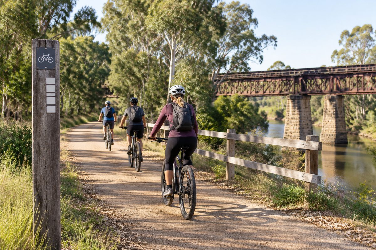
O’keefe Rail Trail: Planning a Walk or Ride from Bendigo
The best way to explore the O’Keefe Rail Trail from Bendigo is to choose your turnaround point and return plan before you leave. The full route to Heathcote is close to 50 kilometres, so it is a serious one-way ride rather than a casual outing. Shorter sections near Bendigo work well for walkers, families and riders who want an easy half-day trip.
The trail follows the route of the former Bendigo to Heathcote railway. Its gentle railway grades make it easier than many bush tracks, but distance, heat and the return journey can catch people out. A clear plan turns the route into a relaxed day instead of a long push back to town.
Where should you begin in Bendigo?
Bendigo Railway Station is a useful starting point if you arrive by train or want to begin near the city centre. From there, use the signed urban route that connects with the main trail. Riders starting by car may prefer an access point closer to the eastern edge of Bendigo, especially if they want to avoid city traffic.
Check the current route map before leaving. Urban connections can change when road works or path upgrades affect local Cycling infrastructure. A saved map also helps where signs are less obvious at street crossings.
Starting from central Bendigo adds distance before you reach the quieter rural section. Count that distance in both directions if you plan an out-and-back trip. A route that appears to be a 20-kilometre outing can grow once travel from your parking place is included.
How far should you walk or ride?
Choose distance by working backwards from the time and energy available for the return. Most walkers should select one local section rather than attempt the entire trail. Recreational riders can reach Junortoun or Axedale and return, while experienced riders may continue through Knowsley to Heathcote.
- Short walk: Pick a Bendigo-side access point and walk for 30 to 60 minutes before turning around.
- Easy ride: Ride toward Junortoun, then return while everyone still feels fresh.
- Long day ride: Use Axedale as the main destination and rest point.
- Full route: Continue to Heathcote with a booked pickup, support vehicle or overnight plan.
Junortoun is roughly the first major settlement east of Bendigo. It gives new riders a useful test of pace without committing them to the more remote sections. The route to Axedale is a better goal for fit riders who can handle several hours on the bike.
The section beyond Axedale feels more rural. Knowsley, Victoria provides another point on the route, but services may be limited. The final approach to Heathcote, Victoria suits riders who have carried enough water and already know how they will get home.
Why does the return journey need its own plan?
The trail is linear. Every kilometre travelled east must be covered again unless another form of Transport is waiting at the destination. This is the planning detail most likely to change the whole day.
A rider who reaches Axedale after an easy morning still has a long ride back into Bendigo. Wind, rising heat or a sore knee can make the return feel much harder. Turning around when half your planned time has passed is safer than turning when half your energy feels gone.
For the full Bendigo to Heathcote route, arrange a lift before starting. Confirm the pickup place and time with the driver. Save the driver’s number and share your live location if possible. Do not assume a regular passenger service will carry a bicycle. Local services, booking rules and bike capacity can change.
Two-car shuttles can work when riders travel together. Leave one vehicle at the finish, then drive everyone and their bikes to the start. Check parking signs at both places and keep valuables out of sight.
What is the trail surface really like?
The route uses a mix of formed paths and compacted gravel. Some urban links feel smooth and quick. Rural parts can have loose stone, soft edges or small ruts after rain. A hybrid, gravel bike or mountain bike is usually more forgiving than a road bike with narrow tyres.
Walkers should wear shoes with grip. The grade is mild because the route follows old Rail transport land, yet the surface still demands attention. Loose gravel can move underfoot, and repeated kilometres on a firm path may cause hot spots or blisters.
Slow down before road crossings and bends. A railway route may appear straight and simple, but vegetation can hide another path user. Keep left, pass with space and use a bell early. Dogs should remain under close control where permitted because cyclists may approach at speed.
Rain can alter the surface even when the trail remains open. Check local notices after storms, floods or strong winds. Fallen branches and washouts matter more on the quieter stretches where help is farther away.
Which stop makes sense for a first outing?
Junortoun is the better target for a short first ride from Bendigo. It lets you learn how your body, bike and group respond to the surface. If everyone arrives with plenty of time and energy, extend the ride a little before turning back.
Axedale suits a longer outing. It is a natural break in the route and a practical place to pause before deciding whether to continue. The Campaspe River crossing also gives this section a clear sense of progress.
Do not build the day around finding an open shop at the exact moment you arrive. Opening hours can change, especially on quieter weekdays. Carry enough food and water to finish the planned section without buying anything.
Lake Eppalock appears close on a regional map, but it should be treated as a separate side trip rather than an automatic trail stop. Reaching a chosen lake access point may require extra road travel. Add that distance only after checking the road, traffic and access conditions.
What will you see along the route?
The route moves from Bendigo’s urban edge into open country in North Central Victoria. The change is gradual. Houses thin out, road noise drops and the old rail corridor becomes easier to read in the shape of the land.
Remains linked to the former railway explain why the trail follows such a steady line. Cuttings, embankments and station areas show how trains once moved through the district. This history makes the route different from a purpose-built recreation path.
It is best described as a rail trail rather than an operating Heritage railway. The old corridor has been adapted for walking and cycling, so users should expect path travel rather than a train attraction. The historic setting still adds interest, especially around former station sites and small settlements.
Between towns, watch for farm access points and public roads. The peaceful setting does not remove normal road risks. Stop where signs require it and make eye contact with drivers before crossing.
When is the safest time to leave?
Start early during warm weather. Much of the rural route is exposed, and afternoon heat can make a planned return far harder. An early start also creates spare daylight for a puncture, a slow walker or an unexpected stop.
Cool months often suit long rides, but short winter days reduce the margin for delay. Check sunset time and carry working lights even when you expect to finish well before dark. Morning frost or damp gravel may also reduce grip.
Wind deserves as much attention as temperature. A tailwind on the outward leg can hide how much effort the return will take. Check wind direction, then plan the hardest leg while the group is fresh.
Avoid committing to remote sections during severe weather warnings. After heavy rain, check trail conditions and local road closures. This matters near waterways and low sections of the corridor.
What should you carry?
Carry water from the start and keep some in reserve for the final hour. Riders often drink less in cool weather, yet steady movement over several hours still causes fluid loss. Longer trips need food that can be eaten without relying on a café stop.
Every bike group should have a spare tube, tyre levers, a pump and a basic multi-tool. A repair kit has little value if nobody knows how to use it. Practise removing a wheel and fixing a simple puncture at home.
Take sun protection, a charged phone, personal medicine and a compact first-aid kit. Download the route for offline use because mobile coverage may vary. A small power bank is useful on a full-day ride, especially when a phone is being used for navigation.
Walkers should add blister care and enough layers for changing conditions. Riders need an approved helmet and front and rear lights. Check brakes, tyres and chain before leaving Bendigo rather than discovering a fault on the trail.
How can a mixed group avoid a bad day?
Plan for the least experienced person. A distance that feels easy to a regular rider may feel huge to someone using a bike for the first time in months. Ask each person about recent riding experience before choosing the destination.
Set a turnaround time before starting. Agree that reaching a town is optional if the group falls behind schedule. This removes pressure to keep pushing for a named destination.
Keep the group together at road crossings and junctions. Faster riders can wait after each crossing rather than disappearing ahead. On long sections, use planned rest points so nobody feels forced to chase.
Children need a shorter route with fewer road crossings. They may ride strongly on the outward leg and fade without warning. Turn back while they are still enjoying the trip. A trailer or child seat also changes braking distance and handling on loose gravel.
How do you plan the full trip to Heathcote?
Treat Bendigo to Heathcote as a point-to-point day rather than an extended casual ride. The distance is close to 50 kilometres before any detours. Allow time for rests, photos, road crossings and minor repairs.
Divide the route into clear stages. Bendigo to Axedale forms the first broad half. Axedale through the Knowsley district leads into the final run toward Heathcote. This simple split makes water use and pickup timing easier to manage.
Confirm where the ride ends. Heathcote has several possible meeting places, and vague plans cause trouble when a driver and rider wait in different spots. Choose one visible location and share a map pin.
Strong riders may complete a return ride, but that creates a day close to 100 kilometres. Railway grades do not remove the strain of that distance. Attempt it only with suitable fitness, daylight and repair skills.
What should you check on the morning of the trip?
- Check weather warnings, wind direction and expected temperature.
- Confirm the chosen start, turnaround point and finish.
- Review current trail alerts and road closures.
- Test brakes, tyre pressure, lights and phone charge.
- Tell someone your route and expected return time.
- Confirm any pickup before leaving Bendigo.
Choose one realistic turnaround point now, then build your water, timing and return Transport plan around it.